Author: Avery Palardy, EVS ’15. MSc in Hydrology, Boston University
6/27/14
It is hard to believe that almost two weeks ago my life of travels took me from pseudo Africa in Cape Town, South Africa and transported me to the heart of Africa in Northern Tanzania. It was here that I spent a little over ten days traveling as a research assistant with my professor Cindy Ebinger. There were definitely some bumps in the road along the way, literally and figuratively, but isn’t that field work and research; Going to all parts of the world, following a question, searching for an answer, gathering as much information and data as possible, and hoping that all the hard work and stress pays off. Well the information that this research study hopes to gather is about the Great East African Rift system, which Cindy has done extensive research on throughout her career. This active faulting system is desirable tourist area and is a home to the Masaai and other African tribes. It is for their safety and for the development of science that the seismic monitoring systems throughout Northern Tanzania, which Cindy and her team have set up, are being used to collect data on the earthquakes in the area. This information will be used to learn more about this area and the great magma plume that lies beneath the earth’s surface, and will be used to help learn more about the extent of the activity and the dormant volcanoes in the region.
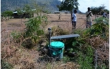
The research is being conducted in a two year study where over 39 seismometers have been placed across the country (4 in Kenya) from areas around Arusha to Ngorongoro Conservation area, in order to get the best understanding of the activity in the area. It was our job to drive to each one of these (with the stations split between another car of team members) to do a system check; making sure that they were working properly, and then after fixing any issues, we extracted the data on the memory cards and replaced them with new ones. This all sounds extremely straightforward in theory, but we did have a few complications along the way. With a lot of negotiations, a few phone calls, and a whole lot of patience, there was nothing that we could not handle. Despite having a couple setbacks we finished in record time with three days to spare. The entire trip was definitely quite an experience. It allowed me to finally visually connect all the pieces of information about faults that I had learned in Cindy’s Geohazards and their Mitigation class that I took in the fall. I got to see examples of almost everything that I had learned about including extinct volcanic craters, dormant volcanoes, eclipse faults, normal faults, flood basalts, volcanic scars, and debris from a volcanic eruption. Even though geology may not be the field that I want to pursue in my future, it is something that definitely is of interest to me, and I enjoyed every moment of this learning experience.
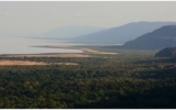
It is almost impossible to write about every single detail about our trip, but I will focus on the highlights and some of the discoveries that I/we made along the way. Before we even reached our first station, I remember very clearly the first stop that we made. It was one of the first chances that I really got an understanding of the expanse of the landscape and how vast the rift is. We stopped on the edge of the Great East African Rift, overlooking Lake Manyara. We were looking out towards the southern end of the rift. Here you could see clearly the normal fault system, rising approximately 600m high. It was very clear the power that water can have on the transformation of landscapes; here there are rivers that have scoured out paths through the fault, shaping the topography that we can see today. After we briefly soaked in the view, we continued on our way.
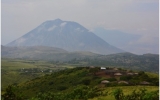
Ngorongoro Nature Conservation Area was the next area that we would be traveling through. It is the location of Ngorongoro crater, which is around 20 km wide, 600m deep and is home to all of the typical African safari animals that so many people pay a lot of money to see. Being able to stand on the edge of the crater was absolutely breath taking. I could not believe that once upon a time where I was standing would have been the side of an active volcano, but now it is just an unbelievable landscape. It is one thing to learn about the processes that can shape the land, and it is another to be able to actually understand what occurred hundreds, millions, billions of years ago by having the opportunity to go right to where it all began. we were driving along, I was shocked by how many microclimates exist in such a small area. There was everything from rainforests to deserts to open grasslands to lakesides. Despite all of these different landscapes that I had never really seen before, there was one spot that stood out to me in particular; it was on a hill, next to a Maasai village that overlooked Oldoinyo Lengai. The rift system was clearly laid out and along its borders was Oldoinyo Lengai. I like to refer to Lengai as my volcano. That is because I wrote my term paper in Cindy’s class on the 2012 and the previous eruptions of Lengai and how they have an effect on the great migrations of the wildebeest and other animals of the Serengeti Plains. The volcanic ash is extremely rich in nutrients, which help to give strength to the new born animals every season. When we first arrived at the station in this area the sky was filled with clouds, blocking the magnificent view. It was a blessing in disguise that this first station took a little longer than the rest. This was mostly due to teaching me what we were supposed to be doing, and just the fact that it took some time to get into the groove of things. This extra time was just what the weather needed to clear the sky, revealing my volcano. It is hard to describe the feeling that I felt; having put so much effort and research into my paper, and then being able to see it, was phenomenal.
Later on in the week, we were driving quite far from Lengai and we saw some of the ash scattered across the ground that had traveled an incredible distance during the 2012 eruption. When you read something about how far something travels, you never really quite grasp what that actually is referring to, but this was my opportunity to experience it for myself. This also held true when we were closer to the flanks of Lengai and I was able to see the volcanic scar that was left behind from the eruption and the lavas that had solidified in the surrounding area. While I did not see it in action, I can easily imagine what it would have been like to witness; the power of the eruption must have been remarkable. While Oldoinyo Lengai is the only recently active volcano in the region, there is some concern that Gelai could erupt in the future. There are cinder cones scattered all along the flanks of Gelai, so I can only imagine the magma that could be lying beneath the volcano. There were so many extinct volcanos throughout the region that we were driving through; I can only imagine how dangerous and eruptive this area must have been in the past.
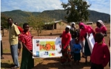
One of the goals of this project is to provide education to the local schools about the region in which they live and to teach them about earthquake and volcanic processes. Most of the stations are strategically placed at schools, so that they get to see what we are actually doing, even if they do not fully understand it. Professor Mazuka, from the Nelson Mandela Institution of Science and Technology in Arusha, had the opportunityopportunity to actually teach some of the children information about one of the posters that we were giving them. It was amazing at how exciting they were and how much eagerness to learn that they had. It helped to show that this project is more than just research; it’s an education opportunity for so many people of all ages, which is great.
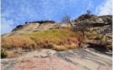
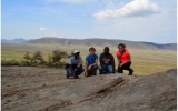
All of these moments that I have already mentioned, were things that Cindy probably expected to happen or that she knew that I would get a chance to experience, but this next one was a surprise to everyone. In between two of the stations that we were driving to, Cindy made a joke about wanting to climb this really steep, tall rock that randomly was sticking out of the flat landscape. It was not until on the way back that our driver, Cleo asked if she wanted to climb it, so he actually pulled over and stopped. The next thing that we knew we were scrambling and struggling to find a decent path to the top of this rock. It was to our surprise that Cindy noticed that there was lake sediments located near the top of this rock. This is unbelievable because we were around 300-400m off the ground and here there were lake sediments! The area that we were looking at must have been a lake at some point, and what we were standing on must have been an island. It was around this time that I realized how important geology really is. It’s not just a bunch of rocks that you have to identify to pass a test, but it is so much more. This gave me an appreciation for being able to know what you are looking at when someone sees a rock; so much can be told about the history of the land, it is incredible. I may not have been the most knowledgeable about the geology of the area, but I certainly appreciated everything that Cindy explained to me.
While I might not have been doing any analyzing of the data, I was rather impressed with how a device, which is charged by a solar panel, can continuously record data for six months at a time and almost never have any break in the data. There were hardly any issues with the stations; there was a battery stolen at one location, but a problem with the GPSs which once existed, no longer was an issue. This is extremely exciting for science and Cindy’s project. This means that there are thousands of recorded earthquakes over the past six months, which can be used to draw some conclusions about the surrounding area. In the fall semester I am going to take some time to practice reading seismometer data, so that I can fully understand what we were doing.
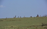
This was a trip that was full of dust, flies, stress, success, long bumpy drives, good company, great soccer, attempts to learn Swahili, and a greater appreciation of geology. While it had some ups and downs, I enjoyed every moment of it; knowing that I was extremely lucky to get this hands on experience that so many people would be envious of. I never would have thought that science would have taken me to a place where it was common for zebras, giraffes, buffalos, and the occasional elephant to walk across the road. It definitely was an all-around learning experience that forced me to learn on the spot what I was expected to do, and then shortly after teach someone else how to do it. Maybe one day I shall return to this beautiful country, but until then, Tanzania, thank you for the great educational experience!
Cheers,
Avery

