NSFGEO and NERC Collaborative Research: Crust and mantle structure and the expression of extension in the Turkana Depression of Kenya and Ethiopia
Rebecca Bendick, University of Montana, Lead PI
Ian Bastow, Imperial College, London
Cindy Ebinger, Tulane
Atalay Ayele and Elias Lewi, Addis Ababa University
Gladys Kianji, University of Nairobi
Nicholas Mariita, Dedan Kimathi University TRAILS_2019_networks
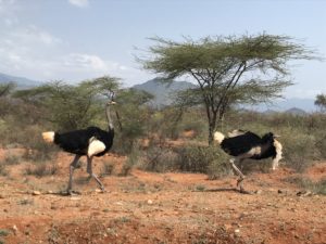
The TRAILS experiment is focused on quantifying the role of three different factors in influencing plate break-up: preexisting structures and density contrasts in the lithosphere inherited from long past tectonic processes, present topography that may supply potential energy for breakup, and pushes and pulls on plates from motions of the convecting mantle beneath. The Turkana Depression of northern Kenya and southern Ethiopia is an ideal place to investigate the contribution of each of these factors because it is probably the location where anomalous mantle first interacted with the African lithosphere to produce magma, it has a lot of inherited structure, and it has very little topography compared to adjacent parts of the rift. By measuring the detailed properties of the lithosphere and crust in Turkana using seismic techniques and simultaneously measuring the rate and location of stretching using geodetic techniques, we can compare the importance of each of the three factors in influencing the initiation and evolution of a new plate boundary. Knowing how new boundaries form in space and time allows us to better understand the tectonic evolution of the planet over its long history, to identify past, current, and future plate boundaries, and to understand the natural hazards associated with tectonic boundaries, such as earthquakes and volcanos. Although the seismically and volcanically active Turkana Depression appears to represent the end member conditions of very low topography, very high material heterogeneity, and elevated mantle geotherms, it has yet to be investigated in detail with modern geophysical methods. Our multi-method geophysical investigation of the Turkana Depression combines seismic and geodetic data collection for seismic imaging, earthquake source mechanisms, surface kinematics, crustal strain rates, and structural architecture. Systematic comparisons of the data products to one another, combined with inverse models of geodetic, structural, and earthquake data and limited forward numerical simulations of rift topography and strain patterns will test basic hypotheses about the role of GPE and crustal architecture in continental rifting. Doing so will help to resolve the longer-term rift evolution, especially the role of one or two mantle plumes, inherited continental structure from Mesozoic rifting, and topographic feedbacks in contributing to and shaping continental breakup.
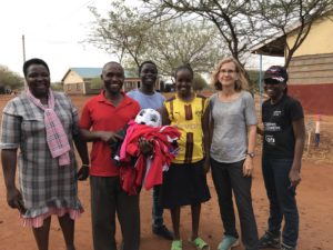
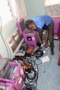
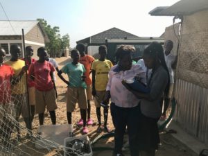
In January and February, 2019, we deployed 32 seismometers and 8 continuous GPS in SW Ethiopia and NW Kenya. Our sites are secondary and primary schools where we engage teachers and students and provide IRIS and UNAVCO teaching material. The Tulane men’s soccer club donated jerseys and other gear, and our UK partners provided books and calculators.
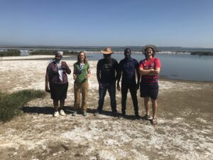
Graduate students who donated sweat and humor include Martin Musila and Garrett Sullivan (Tulane), Chris Ogden (IC), Samuel Mwangi, Mary Muthoni, Bruce Mutegi, Benson Onguso, Maggie Wanyaga (UoN), Emma Chambers (Tulane & Soton), Brandon Shuck (UTIG), Martin Musila, Philip, Victoria (DeKUT).
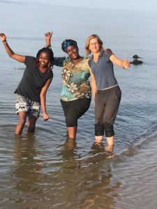
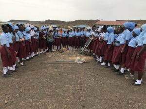
CW from left: Mary, Gladys and Cindy in Lake Turkana; Explaining earthquakes to Maikona Girls Secondary; Ille Primary School; Football gear to Sasura Girls Secondary School with Philip and Maggie. See Blogs for more.